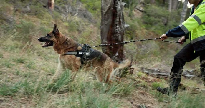
In avalanche country, survival is measured in minutes; LouLou’s 50-hour saga shows how modern crowdsourced tech, disciplined volunteer search, and a dog’s own instincts can bend that rule when the victim isn’t a buried human but a mobile, resilient animal.
At a Glance
- A 4-year-old poodle–husky mix, LouLou, was swept from a Chugach State Park ridge during an Oct. 10 avalanche and found alive roughly 50 hours later.
- Volunteers used helicopter and drone passes and, critically, intermittent pings from the dog’s Apple AirTag to focus search zones across rugged terrain.
- AirTags do not broadcast live GPS; they rely on nearby Apple devices to relay location, which explains the coarse, sporadic fixes in remote Alaska.
- The rescue fits a familiar pattern: human wilderness risk, animal separation, and consumer tech serving as a directional clue rather than a silver bullet.
What Happened: A dog, an avalanche, and a two-day gap the team bridged
Multiple outlets report the same core narrative with consistent particulars: on Oct. 10, two experienced mountaineers traveling a Chugach State Park ridge above Eklutna Lake triggered or were caught by an avalanche that swept them an estimated 500 feet downslope; their dog, LouLou, was separated in the slide chaos. The men survived and were recovered, but LouLou vanished into complex, snow-loaded terrain. Over the next two-plus days, volunteers organized air and ground sweeps. The breakthrough was not a single pin on a map but a pattern—sporadic, approximate location reports from LouLou’s Apple AirTag that narrowed the search area enough for visual acquisition. She was ultimately spotted alert and largely uninjured, roughly 50 hours after separation, and brought home.
Accounts across regional and international coverage describe the same cadence: an initial search constrained by weather and unstable snow, then a widening volunteer grid supported by aerial assets and the AirTag’s intermittent updates, culminating in a helicopter or high-vantage sighting and a straightforward recovery. That convergence—human eyes, aircraft, and an imperfect but suggestive signal—matches the way wilderness searches actually succeed when the subject is alive and on the move.
How the AirTag helped—and why it didn’t act like GPS
Apple’s AirTag rides on the “Find My” network. It does not determine its own position. Instead, when an Apple device in range detects the AirTag’s Bluetooth beacon, that iPhone or iPad computes its own GPS-derived location and anonymously relays a fix to iCloud. In cities saturated with Apple hardware, this creates a near-continuous breadcrumb. On a sparsely traveled ridgeline in Alaska in October, you get something else entirely: coarse, delayed, and sometimes stale points, separated by hours, depending on whether any hiker, rescuer, or overflying phone-equipped passenger came within range.
That limitation is the reason rescues like LouLou’s read as a mosaic rather than a line. Reports describe “critical clues” from the AirTag—the kind of phrasing that fits how backcountry teams use these signals. A single dot does not deliver a dog; a sequence of dots, even if old and imprecise, bounds the search box. Once the box is small enough for aircraft or high-mounted observers to work with, a living, moving subject can be seen—ears against snow shrubs, a body on a wind-scoured bench, or tracks that hadn’t filled. The AirTag aimed the effort; volunteers closed the gap.
Why a dog can survive what buries humans
Avalanche survival data, training curricula, and medical guidance are focused—properly—on people. For fully buried humans without an air pocket, survivability drops steeply after the first 15 minutes; trauma accounts for a quarter of fatalities before burial, and most others stem from asphyxia as snow consolidates into concrete. That is why transceivers, companion rescue, and trained avalanche dogs exist: to cut minutes from the clock.
Dogs occupy a different risk envelope. A canine may be tumbled but not fully buried, able to self-extricate, or swept onto a stable island of debris. Once a dog is on the surface—shaken, cold, but mobile—the hazard profile shifts from suffocation to exposure, injury, and disorientation. Healthy, double-coated mixes like a poodle–husky can tolerate subfreezing conditions with far greater efficiency than a lightly dressed human, especially if they can find wind-shelter or keep moving to generate heat. That contrast, more than miracle, explains how an animal can be lost for days after a slide yet be recovered in good condition, while human avalanche medicine fixates on minutes.
The human system behind the “lucky” find
Luck favors systems. The pattern evident here is familiar to anyone who has worked backcountry SAR: rapid initial response constrained by conditions; tasking of aerial assets when weather and resources allow; disciplined expansion of the search grid informed by any available telemetry—AirTag hits, footprints, scent, signal reflections; and a final positive ID by eyes or camera. Consumer trackers often matter at the margins. Even critics of AirTag accuracy concede that in low-density areas, accuracy is inconsistent; yet the difference between “somewhere on this flank” and “somewhere in this one-by-two-kilometer box” is operational. In that box, aircraft and optics change the odds.
Trained avalanche dogs—professionals, not pets—remain a critical capability for human burials precisely because their noses can clear large areas quickly. But when the subject is the dog, that same principle flips: people, drones, and helicopters become the wide-area sensors, and the AirTag adds a thin but valuable thread. The Wilderness Medical Society’s practice guidelines capture a truth rescue professionals internalize: there is no single magic tool. Tools layer; teams integrate; outcomes improve when signals, however imperfect, are turned into action.
What this means for backcountry travelers with dogs
Three practical conclusions follow. First, if you bring a dog into avalanche terrain, treat that choice with the same respect you’d give a partner’s safety. That means conservative route selection, snowpack literacy, and a clear plan for what happens if you trigger a slide. Second, consumer trackers are worth the ounce they add to the collar—but manage expectations. In the mountains, an AirTag will function more like a periodic area hint than a live breadcrumb; pair it with a visible collar ID, recent photos, and a local network who can mobilize if separation occurs.
Third, if the unthinkable happens, move fast to convert scattered clues into a search plan. Contact local SAR; share the last known point, direction of travel, and any tracker data; and be ready to stand down when professionals are operating in avalanche terrain. Volunteers are powerful when organized and safe—this rescue’s helicopter passes and drone flights were not happenstance but coordinated effort shaped by terrain, weather, and the AirTag’s sporadic pings.
A dog survived an avalanche and 50 hours alone
LouLou, a poodle–husky mix, disappeared after an avalanche in Alaska swept away two mountaineers. More than 50 hours later, a determined rescue team found the dog alive and largely uninjured. pic.twitter.com/D9FpHpHc5o
— Soul Pearls 🪷 (@SoulPearlsss) October 16, 2026
Why this story endures
LouLou’s rescue resonates because it threads technical reality and emotional truth. There is a dog with a name and a face; there are mountaineers who did many things right and still met the randomness of snow physics; there is a device in a pocket that could not promise precision and yet supplied enough direction to matter. Most of all, there is a community that translated faint signals into a life recovered. The facts are straightforward: about 50 hours after an avalanche in Alaska, a four-year-old poodle–husky mix was found alive, largely uninjured, because human eyes—guided by imperfect technology—were looking in the right place.
Sources:
facebook.com, lastampa.it, ilfattoquotidiano.it, hotairtag.com, seattletimes.com, greenlight.com