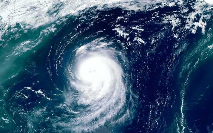
When coastal flooding overruns a place like Newport Beach’s Balboa Peninsula, it is rarely one variable acting alone; it is the alignment of tide, swell direction and period, background sea level, and synoptic wind that turns a forecast hazard into water in garages and living rooms.
The Short Version
- National Hurricane Center advisories on Tropical Storm Rachel called for dangerous surf and coastal flooding as the system turned northeast toward northern Baja and Southern California.
- Rachel’s sustained winds near 50 mph and a forecast approach late weekend created a credible setup for long-period southerly swell, rip currents, and overtopping on south- and southwest-facing beaches.
- Local newscasts showed concurrent flooding in Long Beach and Newport Beach, with officials deploying berms, pumps, and sandbags along Balboa Peninsula.
- Tropical Storm Watches were issued for the coast from the U.S.–Mexico border to the San Diego/Orange County line; coastal hazards were emphasized regardless of exact watch boundaries.
What the forecast said and why it mattered
The National Hurricane Center’s public advisories on Rachel established three operationally important facts: the storm was moving northeast toward northern Baja and Southern California late in the weekend; maximum sustained winds near 50 mph maintained a coherent wind field over warm water; and swells influenced by the system would create life‑threatening surf and coastal flooding along parts of the Southern California coast. Watches are not guarantees; they mean hazardous conditions are possible within the specified area and timeframe. That is precisely what forecasters communicated as Rachel arced toward the region, a message rooted in decades of watch/warning practice designed to account for track and size uncertainty while enabling timely protective action.
In practical coastal terms, the hazard call was about more than wind. A northeastward‑advancing cyclone in the Eastern Pacific generates and focuses southerly swell that can run unimpeded into the bights and harbor mouths of Southern California. With even modest wind at the coast, elevated background sea level, and the wrong tide phase, wave runup and overtopping can spill bayward and streetward. Advisories explicitly flagged surf, rip currents, and coastal flooding, not merely rain bands or gust thresholds, because the compound threat is what floods homes built close to grade on narrow barrier spits like Balboa.
How a peninsula floods: mechanism and local geometry
Balboa Peninsula is a classic low‑relief barrier separating the Pacific from the Newport Bay complex. It is geometrically vulnerable: long fetch exposure to south and southwest swell, shallow overwash pathways at alleys and garages, and limited freeboard during higher high tides. When long‑period swell enters, even 4–8‑foot breakers can deliver runup well past the still‑water line, and if tides ride high at the same time, a few inches of additional background sea level can decide whether water stops at the curb or finds a door threshold. That is why public works departments there pre‑stage sand berms, portable pumps, and sandbags before a forecasted swell pulse; the objective is to buy inches of elevation and minutes of drainage at the worst of the tide cycle.
This event fit that playbook. Regional television coverage documented flooding across multiple coastal jurisdictions, including Newport Beach, as Rachel approached. Reports described water into lower‑level garages and several blocks of inundation on the peninsula, with city crews reinforcing berms and running pumps as additional high tides and rain were expected on Sunday. Viewers heard the same operative elements repeated: southerly swell energy, elevated tides, and a storm approaching from the southeast quadrant—all ingredients that convert forecast “life‑threatening surf” into street‑level consequences in South Bay and Orange County beach communities.
The watch line and the hazard footprint
One detail that often confuses the public—and sometimes media chyrons—is the difference between a tropical storm watch polygon and the broader hazard footprint. In this case, the NHC issued a Tropical Storm Watch from the U.S.–Mexico border to the San Diego/Orange County line. A watch is a wind‑centric product keyed to the possibility of tropical‑storm‑force winds in a defined coastal segment; it is not a complete map of where surf, rip currents, or coastal flooding will occur. Surf and runup are controlled by swell propagation and local bathymetry; they will impact well north and south of the watch edges if the wave energy and tide timing align. The advisory language reflected that reality by calling out dangerous surf and coastal flooding risks along the Southern California coast independent of exact watch endpoints.
That distinction matters on a place like Balboa. The peninsula’s south‑facing exposures can be hammered by south and south‑southwest swell even if the strongest winds remain south of the county line. Meanwhile, back‑bay water levels respond to tidal phase and setup. In compound events, wave overtopping from the ocean side and restricted drainage toward the bay can briefly trap water in the built environment. Emergency managers plan for that geometry; their protective measures are triggered by the coastal hazard suite, not only by the presence of a wind watch boundary.
Why the forecast emphasis on surf and flooding was sound
Rachel’s advisories highlighted surf and coastal flooding because the system’s track and size, in concert with the weekend tide cycle, created a credible, time‑bounded exposure. Forecasters have steadily expanded beyond point wind forecasts to communicate associated hazards—surf, storm surge, rainfall—because these produce much of the damage and risk to life. In the last decade, NHC and local offices have improved hazard‑specific messaging while preserving lead time; the point is to cue protective action in the high‑consequence window, not to wait for deterministic certainty. That doctrine, documented in outreach and performance reviews, underpins why a “possible” in a watch product can—and should—move people and resources when coastal flooding is on the table.
The simultaneous presence of a seasonal or El Niño‑enhanced background sea‑level bulge can amplify impacts by inches that matter at the doorstep. Long‑period swell, arriving atop a higher astronomical tide, increases total water level at the shoreline and the probability of overtopping; even where rainfall totals remain modest, the timing of showers during peak tide can exacerbate drainage. None of this requires exceptional crest heights to flood low garages; it requires alignment. Rachel provided that alignment window, and local reporting showed the outcome in streets and structures.
A note on evidence and attributions
The core claims here are straightforward and supported by the public advisories and contemporaneous broadcast reporting: Rachel turned northeast toward Southern California; sustained winds remained near tropical storm thresholds; forecasters warned of life‑threatening surf, rip currents, and coastal flooding; and coastal neighborhoods including parts of Newport Beach experienced flooding and emergency protective operations during the approach period. As always with compound coastal events, multiple forcings—swell, tide, background sea level, synoptic pressure and wind—contribute to the observed inundation. That complexity is why forecasters emphasize coastal hazards explicitly alongside wind, and why emergency managers act on that messaging.
Orange County California – Coastal Risk Analysis and Forecast
Fresh nearshore data now confirms a powerful 20-second SSW component in Orange County; Sunday remains HIGH with localized SEVERE impacts possible.
Forecast issued: Saturday, October 10, 2026 — 3:30 AM PDT
Current…— OC Beach Status (@OCBeachStatus) October 10, 2026
What practical preparedness looks like on the peninsula
For residents and property managers on low‑lying spits, the operational lessons are durable: track not just storm position and intensity but tide tables and swell period; elevate vehicles and critical contents above garage slab; pre‑place water barriers before the first high‑tide window in the advisory period; and coordinate with local public works on berm integrity and pump access routes. For cities, success is measured in inches—of additional berm freeboard, of doorway protection, of pump head achieved against tidal backpressure. Those small margins, cued by hazard‑specific advisories, are what keep recurrent flooding from becoming structural loss.
Sources:
thegatewaypundit.com, nhc.noaa.gov